


UAS Photogrammetry and Inspection
FIT creates custom flight plans and acquires data for photogrammetry and infrastructure inspection for industrial use. FIT has experience modeling large stacks, headframes, dams, dikes, and buildings. Data products include point cloud analysis and classification, 3D mesh generation and digital terrain modeling, high resolution photography, and more.

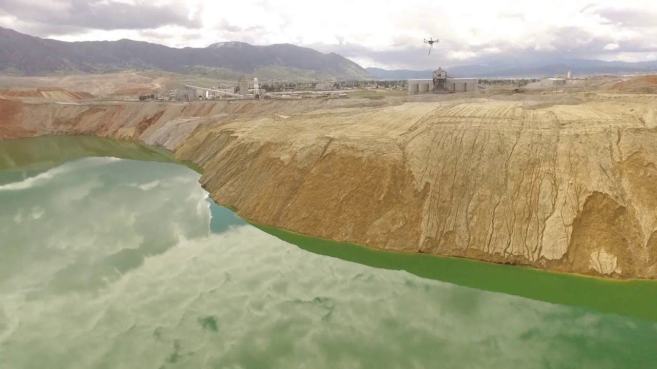
UAS Water Sampling
FIT scientists and engineers designed a Water Sampling Platform (WaSP) for use on commercially available unmanned aerial systems (UAS). This technology can be quickly and easily deployed in any hazardous or inaccessible surface water body, allowing for routine sampling and monitoring. The WaSP includes a modified gimbal plate for first-person viewing and a custom winch for raising and lowering a maximum 3 kg payload to a depth of 140 m. Current payloads include a YSI EXO1™ Sonde (profiling depth, temperature, dissolved oxygen, conductivity, pH, ox-redox potential, and turbidity) and remotely activated discreet samplers such as a HydraSleeve™ or Niskin bottle.

Unmanned Marine Craft
Remotely operated water craft were developed by FIT for waterfowl interdiction. The boats are suitable for corrosive environments and can be outfitted with custom plates, such as a reel system or modular arms for scooping samples. You can view our water craft in action on our Media page.

Special Projects
FIT designs, programs, constructs, and deploys custom scientific equipment for environmental monitoring. We have experience providing these services and equipment for a variety of clients in extreme and hostile environments such as active volcanoes and mining areas. Past projects include hazardous gas monitoring and weather triggered optical sensors. Contact us today to discuss your specific applications and remote data collection needs.

Remote Sensing and Analysis
FIT scientists are experienced with satellite, airborne, and unmanned aerials systems (UAS) image analysis including multispectral, hyperspectral, and point cloud analysis for vegetation health, site inspections, mapping and more. FIT maintains a number of UAS platforms and instruments to collect RGB, calibrated multispectral, and thermal imagery depending on project scale and data needs. Flight-planning and GPS ground control services are available for custom UAS applications, as well as geospatial mapping, analysis, and geodatabase services.
UAV Water Sample Collect